The Deschutes River at
Bend, Oregon
The Deschutes River at Bend, Oregon, 2021 — Ink, watercolor, algae pigment, and forest fire charcoal on paper
My fourth piece in my After Ehrenberg series is the Deschutes River at Bend, Oregon, formerly known as Farewell Bend. I have a fair amount of confidence in the location of this sample as the database has specific descriptors, including some latitude and longitude coordinates noted:
Oregon Freemont. 60 mittlere Schicht. Notiz: No. 60 Freemonts Report Fossil (fluviatile) Infusoria banks of Riviere aux Chuttes Oregon
Oregon, aux Chuttes. Fremont 1843 1. N.59 Columbia River Longit. 121° Latit.44 1/2° Bailey Aug. 1848 500 Fuss hoch darüber 100 Fuss dieser Gestalt und oben [andere] vulk.[…]
The database lists the sample provider is listed once again as Jacob W. Bailey who was associated with both the Frémont Expedition and the U.S. Exploring Expedition. 1843 is the listed collection date, aligning with the Second Frémont Expedition that mapped much of the interiors of Washington and Oregon, at the time Oregon Territory. The latitude and longitude listed locate the sample approximately at Bend, Oregon, although the exact location is in the now Deschutes National Forest.

Partial map of the first and second John C. Frémont Expeditions mapping what was then Oregon Territory and the disputed California Territory, 1845.

Vintage postcard of Celilo Falls before the construction of The Dalles Dam. These falls provide the namesake of the Deschutes River.
All samples for this river are given their historical per-standardized name aux Chutes, or Fall River. Now Americanized to Deschutes, meaning “the falls” in French, the Deschutes was named for Celilo Falls, now under The Dalles hydroelectric dam, a powerful series of waterfalls at the mouth of the river.
I have the highest level of confidence in the sample location for these particular entries. Latitude, longitude, and consistent collection dates make these samples easy to pinpoint. Bend, Oregon (once known as Farewell Bend due to it’s emigrant location for river fording) is a known Frémont Expedition location, clearly outlined in the maps produced from the expedition. Home to multiple first nations tribes like the Confederated Tribes of Warm Springs, Bend has been an important river crossing and population site for thousands of years.
This sample was collected for me by a friend from downtown Bend, Oregon, one of the many esteemed members of my Diatom Correspondence Course.
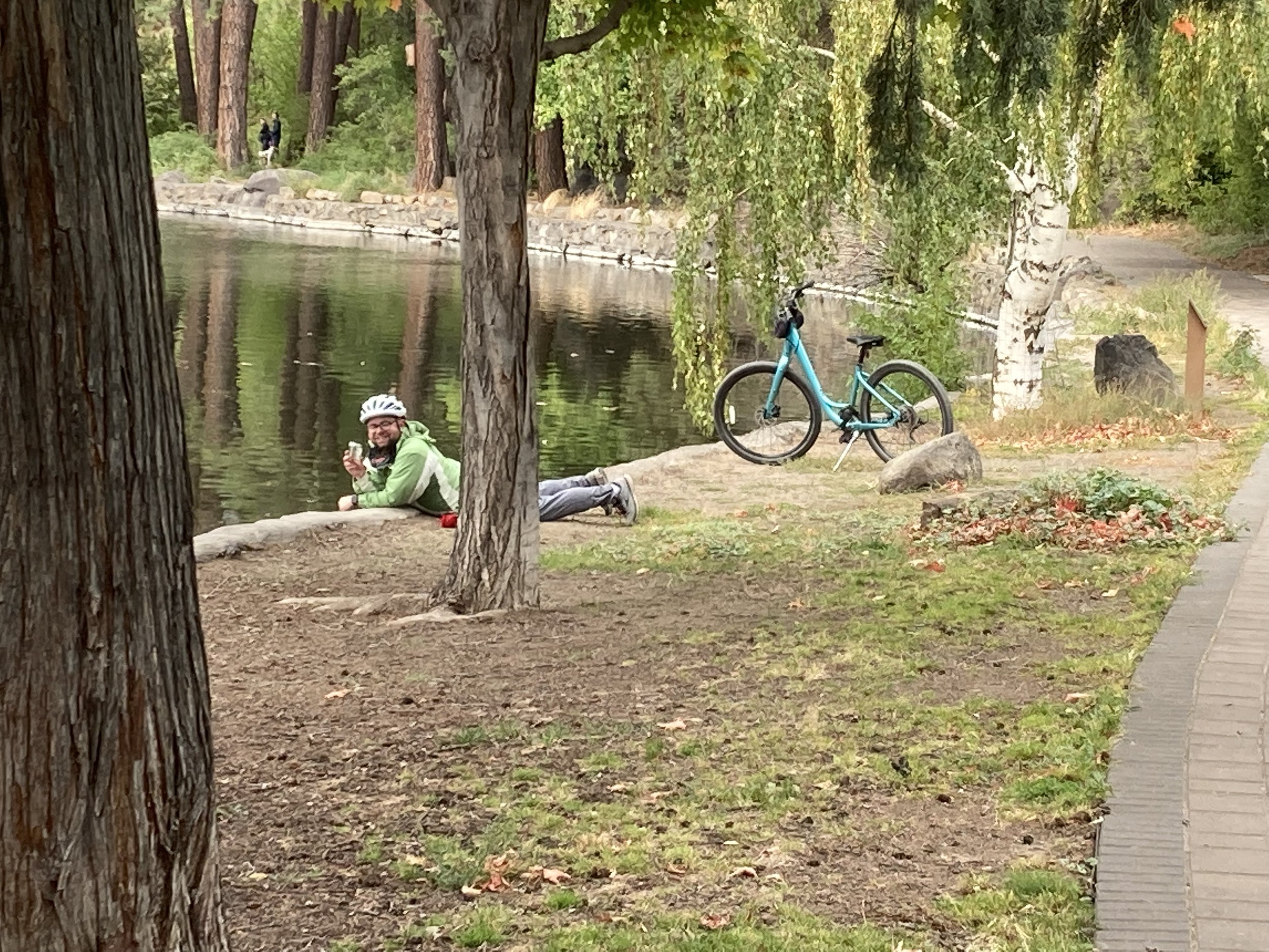
A Diatom Correspondent collects samples from the Deschutes River at Pioneer Park in Bend, Oregon
Dr. Ehrenberg’s observations

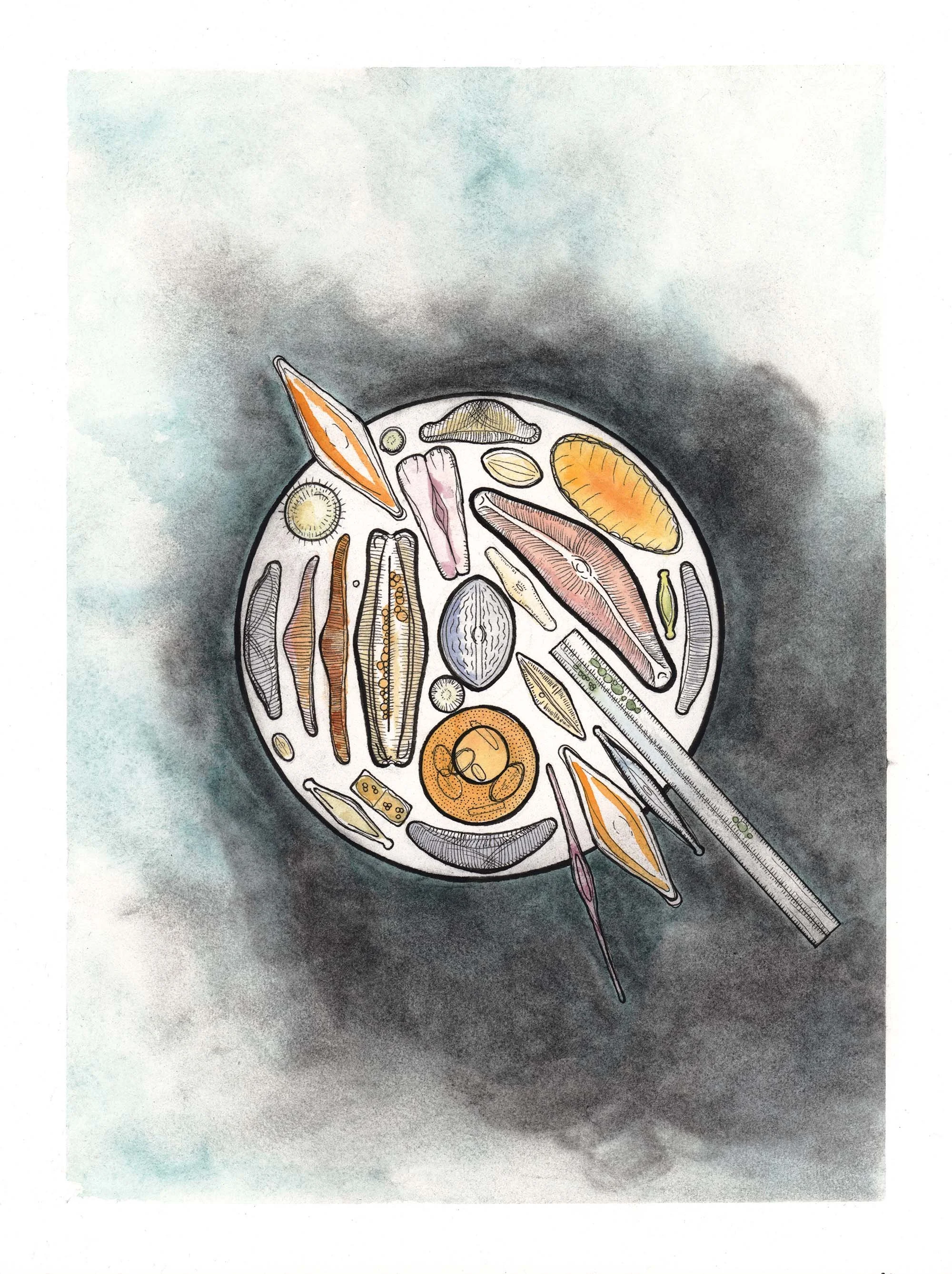
This image shows “aux Chutes” microorganisms specifically, reflecting a small composition focused on this particular river. Image used with permission from the Natural History Museum of Berlin.
In addition to Dr. Ehrenberg’s illustrations for Microgeologie and his large assemblages, this small work with a compact composition. This oval contains Cocconeis gemmata, Discoplea oregonica, Eunotia Westermanni, Gomphonema herculeanum, Mamilla, oregonica, ; Gallionella crenata, Fragilaria amphicephala, Pinnularia oregonica, ; Rhaphoneis oregonica as listed by the database.
My observations
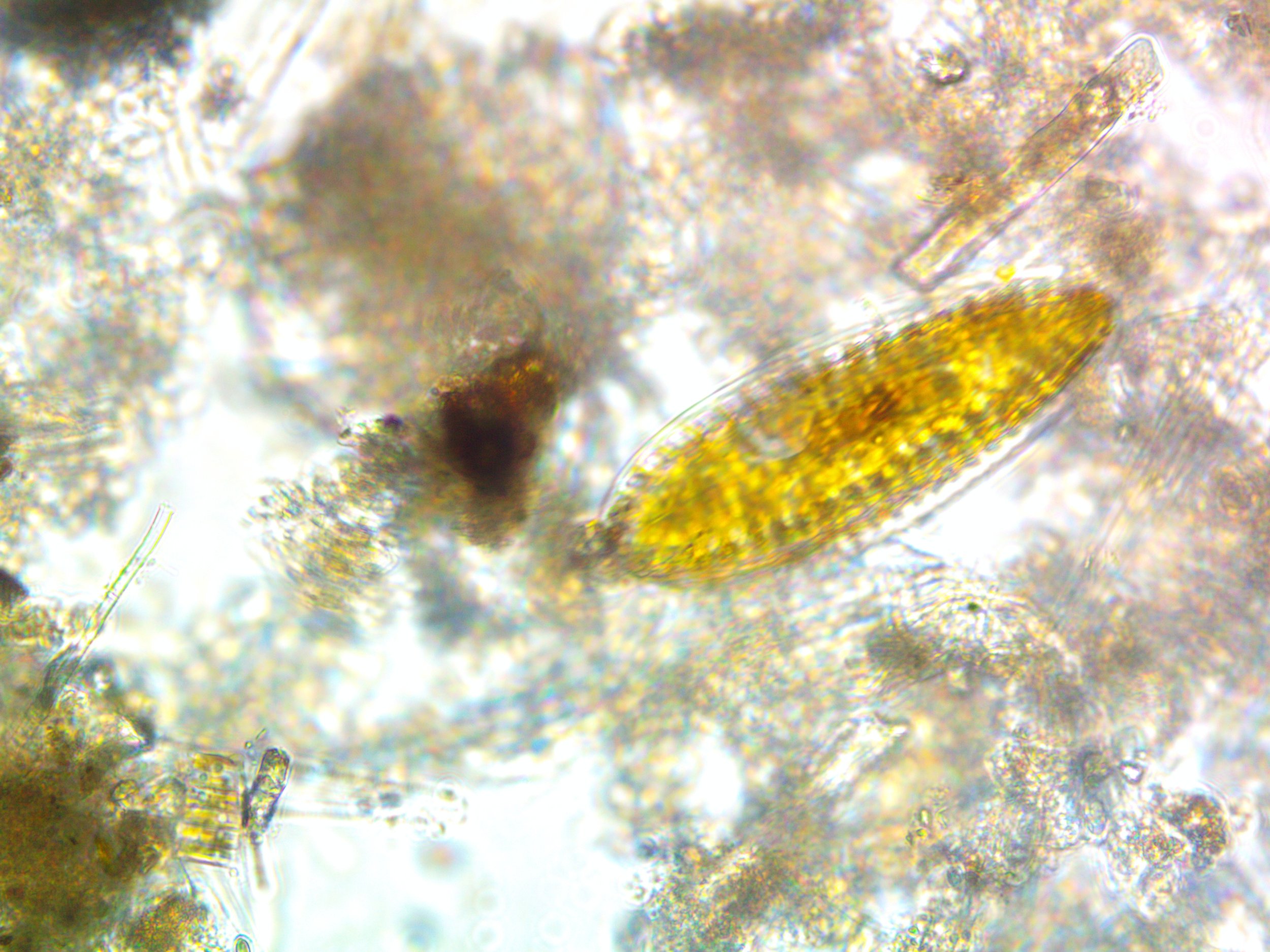
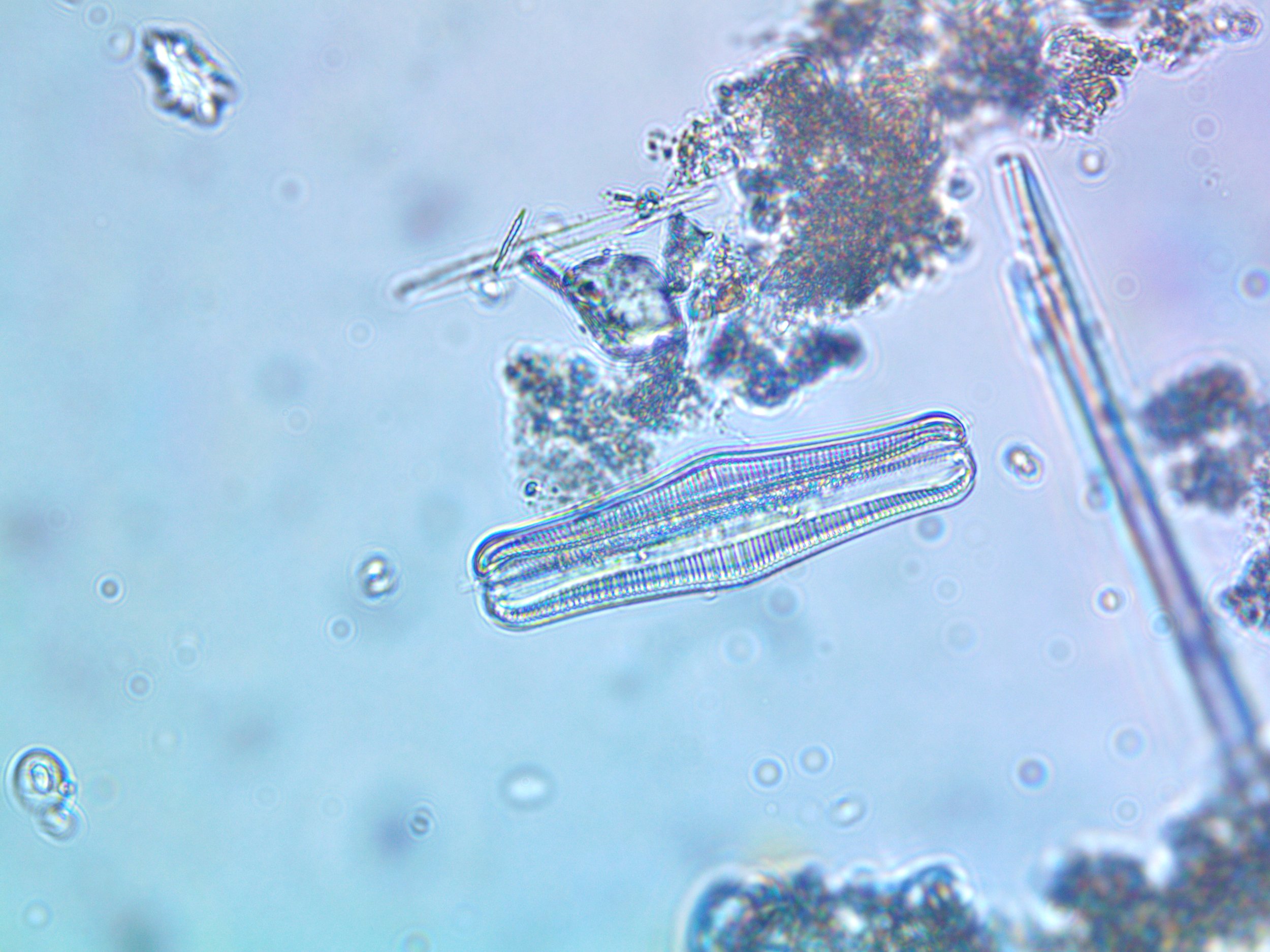
My observations align with the historical record for this sample, with Surirella, Coccoenis, many types of Eunotia, and small centric diatoms observed in my sample. I also observed many Arcella amoeba in this sample, probably due to the sample’s location near residential areas and population centers providing rich nutrient sources for this section of the river.